
Visibility and Cloud Base Indicators
Selecting the Visibility and Cloud Base Indicator thresholds from the map display settings page presents the user with a colour coded overview of the latest observations from around the UK and at offshore locations. This mode evaluates only the reported visibility and the lowest significant cloud base (BKN/OVC) and amount from the latest METAR against pre-defined threshold ranges and are updated following every new METAR.
The displayed colour status (Red/Amber/Green/White/Blue) is determined by the lowest reported parameter (either visibility or cloud base as applicable). These indicators are a good way of ascertaining quickly the conditions over an area without viewing the full observation, and is intended to support specific use cases, such as emergency services or instrument approaches. A definition of the meaning of each colour is shown in the ‘I’ icon on the base map. These threshold ranges cannot be amended.
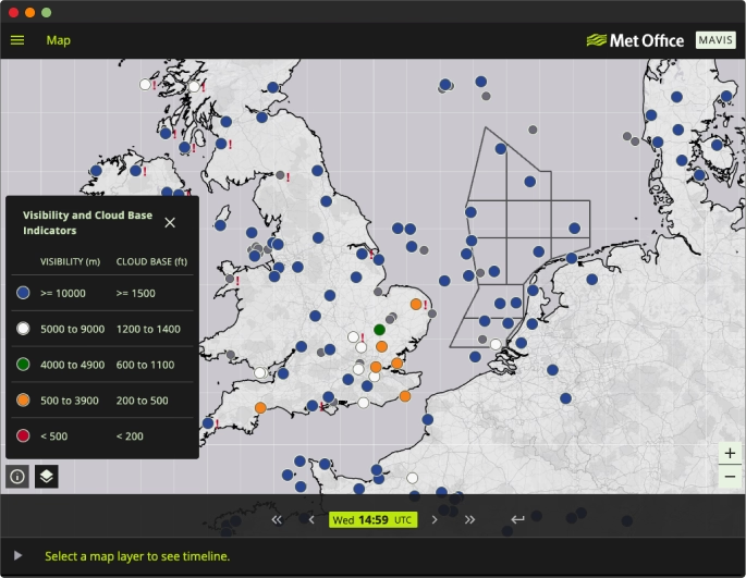
METARs older than 2 hours or otherwise unavailable will appear as grey, as they are incomplete METARs for which a visibility and cloud base indicator cannot be determined.