Customisation
There are various customisation options available in MAVIS.
Basemap Styles
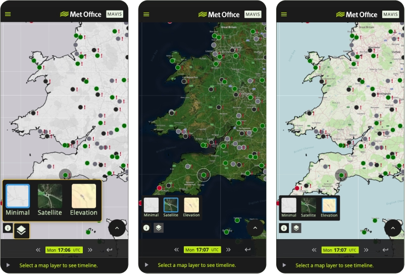
MAVIS allows users to select from a choice of three basemap styles; “Minimal”, “Satellite”, or “Elevation”. This can be selected by navigating to the basemap menu on the bottom left of the map window.
Map Display
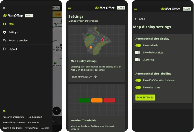
Users can also customise which aerodromes they can see on the map. Selecting the three-bar button on the top left of the MAVIS map, followed by selecting the “Settings” option navigates you to a new window where a user should select the “EDIT MAP DISPLAY” option in the settings page.
Once here, options exist to toggle on and off various groups of aerodromes, as well as the option to cluster aerodromes on the base map. The groups available to users will be different depending on access requirements, so the groups below may not be representative of those you see in MAVIS.
Pinning
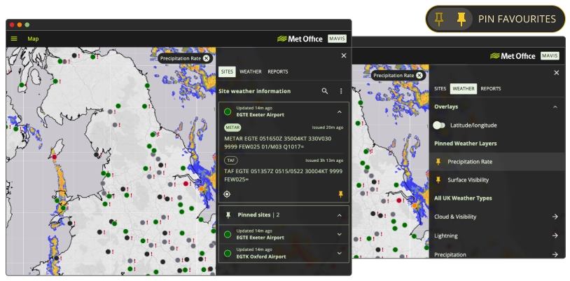
Sites, weather map layers and reports can be ‘pinned’, such that they will appear on your pinned list when you navigate to and from the “SITES”, “WEATHER” or "REPORTS" section of the menu. To pin a map layer, simply click the 'pin' icon next to the layer name. For sites, select the site on the map and click the 'pin' in the bottom right of the ‘site weather information’ section. Pinned sites will appear at the top of the “SITES” menu if no other sites are selected, or below when another site is selected.